
ROAD SURVEY
Road Maintenance Planning in Kuwait: Using Roughness Data to Prioritise Repairs
Road maintenance planning in Kuwait works best when decisions are based on measured data rather than visual impressions. Road roughness, reported as the International Roughness Index (IRI), is one of the clearest indicators of pavement condition and ride quality. This guide explains how to collect roughness data with the Roughometer III by ARRB Systems, available from Burgan Equipment Co., and how to turn that data into a clear, defensible maintenance plan.
What Is IRI? A Quick Definition
The International Roughness Index (IRI) is a standard measure of how uneven a road surface is along the wheel path. It is reported in metres per kilometre (m/km). A low IRI means a smooth road with good ride quality. A high IRI means a rough road that is uncomfortable to drive on, increases vehicle wear and usually signals pavement damage. Because IRI is calculated the same way everywhere, results can be compared between roads, between survey years and with other road networks. This is why road agencies around the world use it as a core input for maintenance decisions.
New to IRI? Start with our guide to road roughness measurement in Kuwait.
Why Roughness Data Matters for Maintenance Planning
Every road network has more repair needs than budget. Roughness data gives road owners an objective way to compare roads and decide where to spend first. Instead of relying on complaints or visual inspections, engineers can point to measured values for every section of road.
- Good road maintenance planning in Kuwait uses roughness data to:
- Rank roads from best to worst condition
- Identify sections that need repair now and those that can wait
- Track how quickly each road is deteriorating over successive surveys
- Check the ride quality of newly resurfaced roads
- Support budget requests with measured, repeatable evidence
Kuwait’s long, hot summers and heavy freight traffic place high demands on asphalt pavements. Regular roughness surveys help road owners spot deterioration early, when lower-cost treatments are still effective, instead of waiting until a road needs full reconstruction.
How the Roughometer III Collects Roughness Data
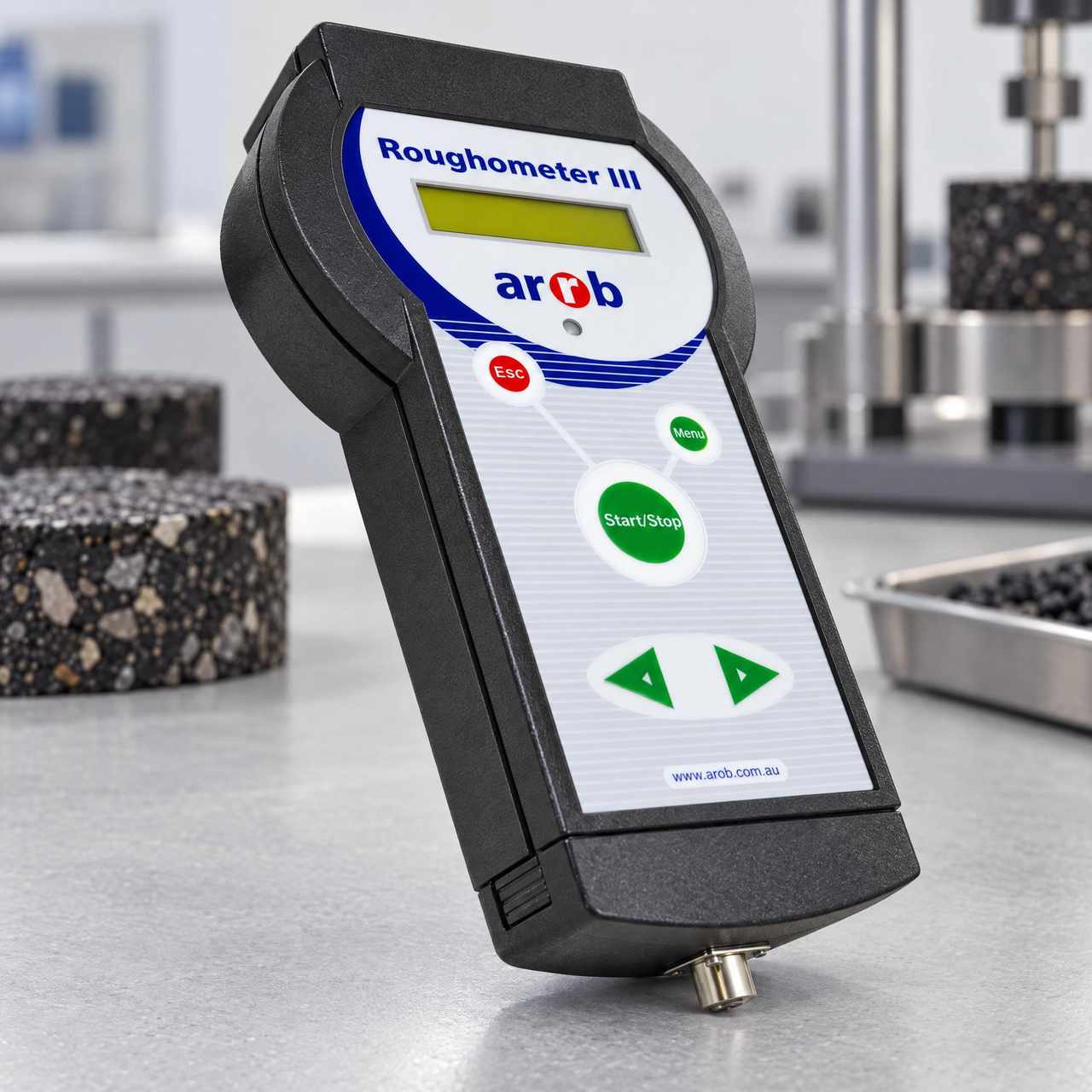
The Roughometer III is a World Bank Class 3 roughness device. A precision accelerometer mounted on the vehicle’s rear axle measures axle movement directly as the vehicle drives along the road. Because it measures the axle and not the vehicle body, results are not affected by the vehicle’s suspension or passenger load, and no experimental calibration is needed to produce a true IRI value.
Key components
- Inertial sensor: a single non-contact sensor on the inside of the driver’s-side rear wheel, with brackets for live-axle and independent rear suspension vehicles
- Distance Measuring Instrument (DMI): a wheel-mounted DMI with distance accuracy better than 0.1%
- Integrated GPS: time-stamped location data, with a magnetic roof-mounted antenna
- Handheld controller: runs the survey without an in-vehicle computer
Key specifications
- Roughness output in IRI or NAASRA counts
- IRI accuracy within ±0.5 of true IRI (within design parameters)
- Data sampled every 50 mm
- Optimal survey speed of 40–60 km/h, depending on road condition
- Stores up to 13,000 km of survey data
- Runs on 12 V DC vehicle power
Five Steps to Road Maintenance Planning in Kuwait
Step 1: Build your road inventory
List every road and section to be managed, with its name, length, class and traffic level. Use consistent start and end points so results can be compared year after year. A clear inventory is the foundation of every maintenance plan.
Step 2: Survey the network
Fit the Roughometer III to a survey vehicle and drive each section at a steady speed within the optimal range. The system records roughness, distance and GPS position together, so every result is linked to an exact location. For a full walkthrough, see how to run a road roughness survey in Kuwait.
Step 3: Process and map the results
Download the data to a PC by USB and process it with the supplied Roughometer software. Results can be reported as tables, graphs, GPS maps or CSV files for use in spreadsheets or a pavement management system. Maps make it easy to see where rough sections are concentrated.
Step 4: Set condition bands and rank roads
Group sections into condition bands such as good, fair and poor, using IRI thresholds agreed with your road authority or client. Then rank sections within each band by traffic and importance, so the busiest poor roads come first.
Step 5: Plan treatments and re-survey
Match each band to a treatment, from routine maintenance to resurfacing. Repeat the survey at regular intervals to measure deterioration and confirm that repairs have improved ride quality.
How Often Should Roads Be Surveyed?
There is no single rule, but survey frequency usually depends on road class and traffic. Main roads and highways with heavy traffic are often surveyed more frequently, while lightly used local roads can be surveyed less often. The most important thing is consistency: survey the same sections, in the same lanes and directions, at regular intervals. This builds a reliable history that shows how each road is changing over time.
Common Mistakes to Avoid
- Surveying at inconsistent speeds: keep to the optimal speed range for reliable results
- Changing section start and end points between surveys: this makes year-to-year comparison difficult.
- Ignoring events on the road: note bridges, junctions and roadworks so unusual readings can be explained.
- Using roughness alone for every decision: combine IRI with traffic data, visual records and laboratory testing where needed.
- Not re-surveying after repairs: a follow-up survey confirms that the treatment improved ride quality.
Roughometer III or Hawkeye 1000?
Both systems are available from Burgan, and they suit different jobs:
- Roughometer III: best when roughness (IRI) is the main result you need. Quick to install, fits most vehicles and suits regular network monitoring.
- Hawkeye 1000: best for full condition surveys that also need surface texture, road geometry and video in one pass.
Frequently Asked Questions
It is based on measured road condition data, especially roughness (IRI), combined with traffic levels and road importance. This lets road owners rank roads and repair the most critical sections first.
No experimental calibration is needed to produce a true IRI. The sensor measures axle movement directly, so results are not affected by the vehicle’s suspension or load.
It fits most vehicles. Mounting brackets are supplied for both live-axle and independent rear suspension vehicles, and it runs on 12 V vehicle power.
Yes. The Roughometer III gives objective, repeatable roughness results on both sealed and unsealed roads.
Related Products
Hawkeye 1000 Laser Profiler
World Bank Class 1 two-laser profiler for IRI, profile and macrotexture at highway speeds.
Explore Our Road & Pavement Testing Range
From road roughness and pavement profiling to deflection and density testing, Burgan Equipment Co. supplies a complete range of road pavement testing equipment in Kuwait, backed by installation, training and local after-sales support.